Driving from Christchurch to Invercargill on State Highway 1 is about 600 kilometres and takes 7.5 to 8 hours without stops, down the east coast through Timaru, Oamaru and Dunedin, then inland through Balclutha and Gore. It is an easy road, mostly two lanes with good passing, and it splits naturally into two days at Dunedin. Most of the interest is on the coast, and the Catlins give a slower way to finish.
Route, distance and time
State Highway 1 is the only through route. From Christchurch it crosses the Canterbury Plains to Ashburton and Timaru, follows the coast to Oamaru and Moeraki, climbs over the Kilmog into Dunedin, then continues south to Balclutha, Gore and Invercargill. The two halves are roughly similar, about 360 kilometres from Christchurch to Dunedin and 240 from Dunedin to Invercargill.
The times above do not include fuel, meals or stops, so allow nine to ten hours for a day that includes a couple of proper breaks. The driving day planner works out a day that suits your vehicle, and the Christchurch to Dunedin guide covers the first half in more detail.
- About 600 km, 7.5 to 8 hours
- Dunedin is the natural halfway stop
- Allow nine to ten hours with breaks
Timaru, Oamaru and Moeraki
Timaru has Caroline Bay, a good beach and a place to stop for lunch, and the Aigantighe art gallery and the Te Ana rock art centre are worth a short visit. Oamaru, an hour and a half further on, has a Victorian precinct of white limestone buildings, a steampunk museum and a blue penguin colony where the birds come ashore at dusk.
Moeraki, 30 minutes south of Oamaru, has the round Moeraki Boulders on the beach, best seen at low tide, and a small fishing village with a famous seafood cafe. Tides matter, so check the tide times before you go. Holiday parks in Timaru and Oamaru are easy to find, and Oamaru is a good place to stop for the night.
- Caroline Bay at Timaru
- Blue penguins at Oamaru at dusk
- Moeraki Boulders at low tide
Turn the stops into a trip
Dunedin and the road south
Dunedin is a good place to spend a night, with the railway station, Baldwin Street and the Otago Peninsula wildlife, and the Dunedin in three days guide plans the stay. South of the city, State Highway 1 climbs over the Chain Hills and descends to the Taieri Plain, then runs inland to Milton and Balclutha.
In winter, ice and occasional snow can make the Kilmog north of Dunedin and the hill roads around the city slippery, so check the road status before you leave. The winter driving guide covers chains and the skills, and a hire company's rules on chains and unsealed roads still apply.
- Dunedin for a night
- Check the Kilmog in winter
- Watch the hire company's rules
The Catlins alternative
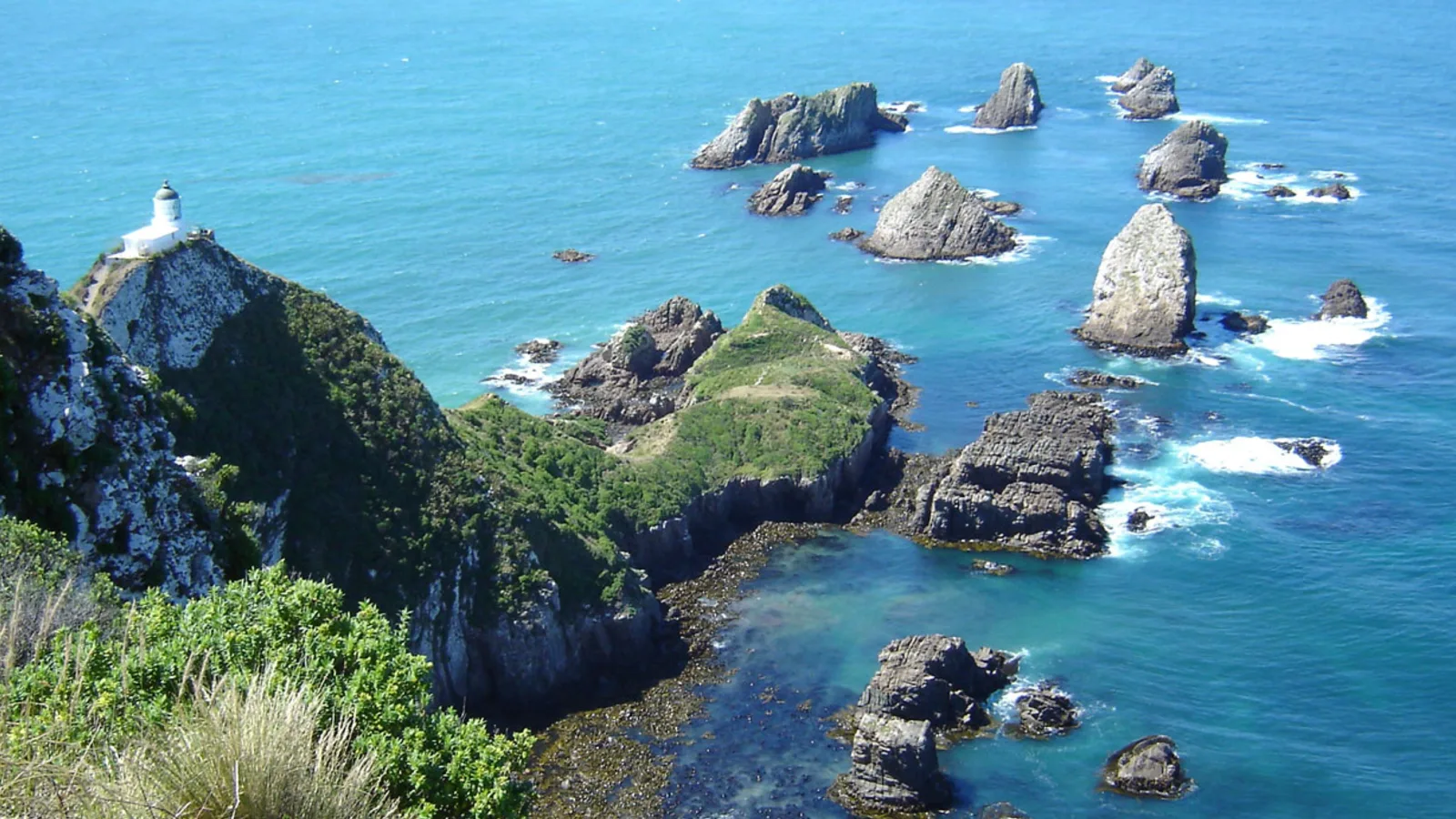
From Balclutha, the Southern Scenic Route, State Highway 92, takes you through the Catlins, with Nugget Point lighthouse, Purakaunui Falls, Curio Bay and the petrified forest, and Waipapa Point. It is a slower, narrower road with more gravel and fewer services, so allow a full day or two, and the guide to the Southern Scenic Route camping has the stops and campsites.
The inland route through Gore and Mataura is faster and the way most freight travels. Gore has the Hokonui Heritage Centre and a giant trout statue, and the Mataura Paper Mill ruins are a curiosity. Both roads meet at Invercargill.
- Catlins: slower, more gravel
- Inland: faster, more traffic
- Both end at Invercargill
Invercargill and Bluff
Invercargill is the southernmost city in the country, with a flat grid of wide streets, Queens Park, the Southland Museum and a good collection of classic cars. Bluff, 30 minutes south, is where State Highway 1 ends, at the Stirling Point signpost, and the town is known for its oysters in season, roughly from March to August.
From here you can go on to Rakiura Stewart Island by ferry from Bluff, or head to Te Anau and Fiordland. Holiday parks in Invercargill and Bluff are easy to book, and freedom camping is limited, as the freedom camping in Southland guide explains.
- Stirling Point signpost at Bluff
- Oysters in season
- Ferry to Rakiura from Bluff
Planning the drive in KiwiCamping
The iPhone app KiwiCamping maps DOC campsites, huts and holiday parks along this coast and filters them for campervan access and facilities. Favourite the places you like, drop them into a trip as ordered stops, and it reports the distance between neighbours and a forecast at each one. Road conditions are outside its scope, so keep NZTA's Journey Planner open while you drive.
DOC bookings stay on DOC's own booking pages. Free to download, with in-app purchases.
- Save stops in driving order
- Forecast at each stop
- Check NZTA for closures
Places along the way
Check before you go
Rules and conditions change. Recheck the official source and the page for your exact park or campground before departure.
Common questions
How long does it take to drive from Christchurch to Invercargill?+
About 7.5 to 8 hours and 600 kilometres without stops, on State Highway 1. Most people split it with a night in Oamaru or Dunedin.
Is the Catlins route better than State Highway 1?+
It is slower and more scenic, with gravel sections and few services, and it adds a day or two. State Highway 1 through Gore is the faster way.

Plan the drive
Save the stops. Plan the whole trip.
Free to download. BookIt holiday parks and tours are free to browse and book; DOC campsites, huts, dump stations, the in-app guides and trip planning need the Premium pass.
KiwiCamping is an iPhone app. There is no Android version.