Punakaiki and the Oparara Basin are two of the best stops on the West Coast, and they sit at opposite ends of the same road. Punakaiki has the Pancake Rocks, rainforest running down to the sea and a good run of places to camp. The Oparara Basin, up the coast beyond Karamea, has giant limestone arches in quiet forest and is far less visited. Both reward an unhurried night or two, and a wet forecast does not ruin either of them.
Punakaiki and the Pancake Rocks
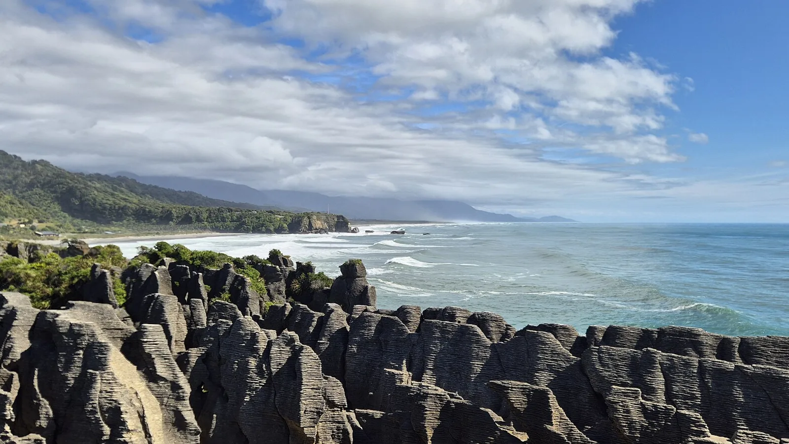
Punakaiki sits on State Highway 6 about 45 kilometres north of Greymouth, in Paparoa National Park. The Pancake Rocks and Blowholes are a short, flat loop walk from the car park across the road from the village, and entry is free. The limestone is stacked in layers like pancakes, and the blowholes put on the best show at high tide with a westerly swell, so check the tide times before you stop and not after.
The village has a small shop, cafes and a few places to stay, but not much else, so top up fuel and food in Greymouth or Westport. Nikau palms grow thickly along this stretch, and the coast road north to Westport is one of the prettiest drives in the country.
- Free loop walk, best at high tide
- 45 km north of Greymouth
- Fuel and food in Greymouth or Westport
Where to camp at Punakaiki
There are holiday parks and private camps in and around the village, some right by the beach, with powered and unpowered sites and a kitchen. They are the easy choice for a van, and the popular ones fill in summer and over the school holidays, so book ahead. DOC has campsites in the wider Paparoa area and beside the Pororari and Fox river valleys, so check DOC for what is open and what each site charges.
Freedom camping is limited near the village, and roadside stopping on the highway is not safe, so decide where you are sleeping before the light goes. The West Coast freedom camping guide has the rules for the wider region, and the Westport guide covers the town to the north.
- Holiday parks and beach camps in the village
- DOC campsites in the Paparoa area
- Book ahead in summer
287 DOC campsites, 927 huts and 262 dump stations in one app
The Oparara Basin and Karamea
The Oparara Basin is about 15 kilometres inland from Karamea, which is itself roughly 100 kilometres up the Karamea Highway from Westport, so allow the best part of two hours each way from Punakaiki. The last stretch is a narrow gravel road with tight bends, and it is not suited to large motorhomes or towing, so check DOC for current road and vehicle advice before you go.
The basin holds the Oparara Arch, the Moria Gate Arch and a series of short walks through beech forest and over tannin-stained, tea-coloured water. The Crazy Paving and Box Canyon caves can be explored with a torch, and Honeycomb Hill Cave is by guided tour only. Karamea has a holiday park, a shop and cafes, and DOC has a basic campsite at the basin and another at Kohaihai at the start of the Heaphy Track.
- About 15 km of gravel, not for large vehicles
- Oparara Arch and Moria Gate Arch
- Karamea has a holiday park and shops
Rain, sandflies and the tide
This is a wet and sandfly-rich part of the country. The coast gets a lot of rain, the forest stays damp, and the sandflies are fierce at dawn and dusk and near water. Bring waterproofs, a plan for drying gear and strong repellent, and treat a wet day as part of the trip, since the forest is at its best soaked. The guides to sandflies and wet weather camping cover both.
Tide and swell also shape the days. The blowholes at Punakaiki are best at high tide, and a few beaches along the coast are not safe to walk at the top of it. Rivers can rise quickly after heavy rain, so check the forecast and the road status before you head north, and do not drive through flood water.
- Waterproofs and strong repellent
- Check the tide for the blowholes
- Never drive through a flooded road
Fitting them into a West Coast trip
Punakaiki fits easily on the way between Westport and Greymouth, with a night in the village and time to walk the Pancake Rocks at the right tide. The Oparara Basin is a detour, and it works best as a night or two based at Karamea or in a campsite in the basin, before heading back south. The Heaphy Track starts and ends near Karamea, and the Heaphy by bike guide covers the trail for riders.
If you are doing the full coast, the West Coast road trip guide and the Christchurch to Hokitika and Greymouth guide cover the rest of the route. The Paparoa Track, a walk and ride that starts near Punakaiki, has its huts booked through DOC.
- A night at Punakaiki, one or two at Karamea
- Heaphy Track starts near Karamea
- Paparoa Track huts: book on DOC
Planning your trip in KiwiCamping
Around Punakaiki and Karamea, KiwiCamping maps DOC campsites, huts and holiday parks, with facilities and campervan access filters, so you can see which camps have toilets and water. Add the camps to a dated trip and read the forecast for each stop, which counts for a lot on this coast.
Booking for the DOC campsites here is through DOC. Download is free, with in-app purchases.
- Save the camps you like
- Add them to a trip with dates
- Forecast at each stop
Places along the way
Check before you go
Rules and conditions change. Recheck the official source and the page for your exact park or campground before departure.
Common questions
Where can you camp at Punakaiki?+
At the holiday parks and private camps in and around the village, and at DOC campsites in the wider Paparoa area. Book ahead in summer, as the popular ones fill.
Can a campervan drive to the Oparara Arches?+
The last 15 km or so is narrow gravel with tight bends, and it is not suited to large motorhomes. Check DOC for current road and vehicle advice before you go.

On the map
Find tonight's camp on the map.
Free to download. BookIt holiday parks and tours are free to browse and book; DOC campsites, huts, dump stations, the in-app guides and trip planning need the Premium pass.
KiwiCamping is an iPhone app. There is no Android version.