Driving from Auckland to the Bay of Islands is about 240 km on State Highway 1 through Whangārei and Kawakawa, and takes roughly 3 to 3.5 hours without stops. The distance adds up the three legs in the Waitangi Treaty Grounds' directions, and the time comes from two official pages that say about three hours and from segment times that run a little longer. The route, its quieter alternatives, a table of official leg figures, fuel and food, the road notes, the Opua car ferry to Russell and the camping options follow in that order.
The drive in one answer
The Waitangi Treaty Grounds give their directions from Auckland in three legs: State Highway 1 north to Whangārei, 165 km, then the signs north to Kawakawa, a further 60 km, then the signs to Paihia, 15 km more. Together that is 240 km, which is this page's own sum, because no page read for this guide states one end-to-end figure. The Treaty Grounds call it an approximately 3-hour drive, and Visit Bay of Islands describes a pleasant three-hour drive north of Auckland via the East Coast highway.
Segment times run longer. WhangareiNZ puts Whangārei city approximately two and a half hours north of Auckland, and Russell Info says Kawakawa is about 45 minutes beyond Whangārei, so the road to Paihia is closer to 3.5 hours before any stop. None of these times allow for fuel, meals, roadworks or holiday traffic. A pause at Waipū, Whangārei or Kawakawa breaks the day into shorter legs, and the Treaty Grounds sit just 2 km from Paihia, so the first afternoon can go to them.
- About 240 km, from the Treaty Grounds' three legs
- 3 hours on two official pages, about 3.5 by segment times
- Fuel, meals and holiday traffic are extra
The fastest route and the quieter alternatives
State Highway 1 is the through road, and Visit Bay of Islands says it runs through the Bay of Islands itself, with towns and sights well signposted. WhangareiNZ calls it a scenic route with many attractions, and suggests following the Twin Coast Discovery Highway from Te Hana to drive the East Coast. Northland NZ describes the Brynderwyn ranges as the inland route on State Highway 1 and sets out a coastal loop from Kaiwaka through Mangawhai, Waipū and Ruakākā, so the two can be combined into a loop from Kaiwaka. NZTA's pages on the motorway extension north of Warkworth and on the Brynderwyn Hills blocked scripts, so this page cannot say which sections are open today.
Two other roads reach the bay. Russell Info says that about 20 minutes north of Whangārei you turn right towards Whakapara and follow the signs for Ōakura, and that a long winding but fully sealed coastal road leads all the way to Russell. DOC's Puriri Bay page gives the same turn as Russell Road, 22 km north of Whangārei. Visit Bay of Islands also names the Kauri Coast route via the Hokianga as a less-travelled way there or back, which the Cape Reinga route guide takes further. WhangareiNZ warns that leaving the main routes can mean unsealed roads.
- Brynderwyn ranges: the inland route on State Highway 1
- Whakapara and Ōakura: the coastal road to Russell
- Side roads may be unsealed
Turn the stops into a trip
Stops and distances from official figures
The table lists each figure as its source states it. Where two pages disagree the cell says so, and the Auckland to Paihia total above is the only sum. WhangareiNZ says the Whangārei district begins 106 km north of Auckland, and Northland NZ puts Mangawhai Heads, the closest holiday destination to Auckland, 90 minutes from the city centre.
Read every time as driving only. Russell Info puts Okiato about 15 minutes from Russell in one paragraph and 10 minutes in another, while Northland Ferries says about 10 minutes, so allow the longer figure. For the stays themselves, the Bay of Islands week guide covers the bay's bases and the Whangārei freedom camping guide covers the district's rules.
| Leg | Official figure | Source |
|---|---|---|
| Auckland to Whangārei | 165 km | Waitangi Treaty Grounds |
| Auckland to Whangārei city | Approximately 2.5 hours | WhangareiNZ |
| Start of Whangārei district | 106 km north of Auckland | WhangareiNZ |
| Auckland city centre to Mangawhai Heads | About 90 minutes | Northland NZ |
| Uretiti Beach turn-off | 5 km north of Waipū, 34 km south of Whangārei | DOC |
| Whangārei to Kawakawa | 60 km; about 45 minutes | Waitangi Treaty Grounds; Russell Info |
| Kawakawa to Paihia | 15 km | Waitangi Treaty Grounds |
| Paihia to Waitangi Treaty Grounds | 2 km, a 2-minute drive | Waitangi Treaty Grounds |
| Paihia to Opua | About 7 minutes' drive | Northland Ferries |
| Opua to Okiato by car ferry | 10 minutes | Northland Ferries |
| Okiato to Russell | About 10 minutes' drive (Russell Info also says 15) | Northland Ferries; Russell Info |
| Paihia to Kerikeri airport | 23 km | Visit Bay of Islands |
- Whangārei to Kawakawa is the longest middle leg at 60 km
- Waitangi is 2 km from Paihia
- Allow the longer Okiato to Russell time
Fuel, charging and food stops
No official page read for this guide lists petrol stations on State Highway 1, so this page names none. For electric vehicles, WhangareiNZ says its district has one of the highest EV ownership rates in the country and a network of charging stations, and points to ChargeNet and PlugShare for maps. NZTA's Journey Planner site has its own EV chargers map and says the details come from the operators. The fuel price apps guide and the food and fuel resupply guide help with the rest.
Northland NZ names a few stops worth leaving the highway for. Waipū has the Waipū Museum, McLeod's Pizza Barn and Brewery, and a quick dip at Waipū Cove. Kawakawa has the Hundertwasser public toilets and Te Hononga Hundertwasser Memorial Park, and the Bay of Islands Vintage Railway leaves from the main street on a 120 minute journey towards Opua. The Waiomio Kawiti Glow-worm Caves are just south of the town. The page lists no opening hours for any of them.
- No official fuel list read for this route
- EV maps from ChargeNet, PlugShare and NZTA
- Kawakawa and Waipū are the natural breaks
Road rules and hazards worth knowing
Traffic keeps left, and the left-side driving guide covers roundabouts and give-way rules, while the campervan road rules guide covers vehicle rules and the one-lane bridges guide covers the single-lane crossings. The Treaty Grounds' own directions mention a one-lane bridge on the last stretch into Waitangi. NZTA's pages on the Brynderwyn Hills closures, detours and speed limits blocked scripts, so this page quotes none and gives no toll information either.
NZTA's Journey Planner site lists road closures, incidents, roadworks and traffic cameras, and warns that its route suggestions come from Google and may show a route that a closure has made unsuitable. It also says every holiday period and long weekend sends large numbers of people out of the main centres to popular destinations, causing queues and delays, and it recommends planning ahead and travelling outside the busiest times. Its holiday journey map predicts the heavy periods, which matters for a Northland run in late December and January.
- Check the Journey Planner on the day
- Plan around holiday weekends
- The last bridge into Waitangi is one lane
Crossing to Russell on the Opua car ferry
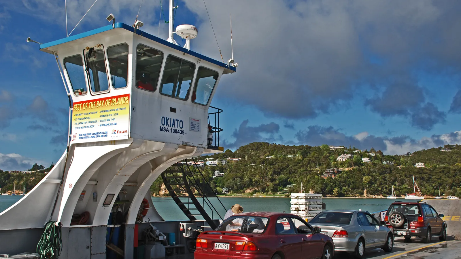
Northland NZ says the vehicle ferry crosses from Opua to Okiato, connecting Russell to State Highway 1. Northland Ferries says the crossing takes 10 minutes, with departures about every 10 minutes during the day and about every 20 minutes early morning and late evening. The first ferry leaves Opua at 6:10am and Okiato at 6:00am, and the last leaves Opua at 10:00pm and Okiato at 9:50pm. Tickets are bought on board, and passengers in the vehicle cost nothing extra.
The operator says the ferries take all vehicles including campervans, and that campervans, being long and low at the rear, can scrape the ramp at low tide, so it asks for travel in the two hours either side of high tide. Trailer boats and caravans have the same advice across a four-hour window. The speed limit on the ferry is 5 km/h. The fares are estimates charged by length, and staff confirm the price at boarding. Visit Bay of Islands names the Paihia Russell passenger ferry as the foot-passenger option.
| Vehicle | One-way fare |
|---|---|
| Car or ute under 6 m | $19.80 |
| 2-berth campervan under 6 m | $19.80 |
| 2-berth campervan with toilet and shower, 6 to 8 m | $33.80 |
| Vehicle or motorhome 8 to 10 m | $41.10 |
| Vehicle or motorhome 10 m and over | $81.70 |
| Motorcycle | $9.70 |
- 10-minute crossing, about every 10 minutes
- Campervans: aim for two hours either side of high tide
- Fare is charged by vehicle length
Where to sleep between Auckland and the Bay of Islands
Whangārei is an accredited Motorhome Friendly Town according to WhangareiNZ, which says tents, vehicles and certified self-contained vehicles each have their own rules and sites, and sends you to the council's freedom camping page. The Whangārei freedom camping guide sets out the bylaw, so it is linked here rather than repeated. Far North District Council, which covers Kawakawa, Paihia and Russell, blocked scripts, so this page states none of its rules. The local council rules guide explains how to check a district's page.
DOC runs two campsites that suit the drive. Uretiti Beach Campsite is 5 km north of Waipū and 34 km south of Whangārei off State Highway 1, with 300 non-powered sites, bookings required, $18 per adult, no fires and no dogs, and a minimum three-night stay from 28 December to 1 January. Its gates are locked from 9:00 pm to 7:00 am. Puriri Bay at Whangaruru North Head is reached from Russell Road, has 90 sites at $20 per adult with bookings required, and DOC says to book well ahead from 1 December to 28 February. Puketī Recreation Area, off State Highway 10 near Waipapa, has 20 sites at $10 and 7 km of gravel access.
The Northland hub in KiwiCamping, built from DOC's data of 11 August 2026, holds 14 DOC campsites, 11 of them bookable online through DOC, and Uretiti Beach is the largest at 300 sites. The Auckland hub holds 9. The holiday parks guide covers powered sites in the towns, and the kauri dieback guide covers the cleaning stations at forest campsites such as Puketī.
- Uretiti: three-night minimum 28 December to 1 January
- Puriri Bay: book ahead from 1 December
- Far North freedom camping rules are not stated here
Planning Auckland to the Bay of Islands in KiwiCamping
KiwiCamping is an iPhone app that puts the campsites, huts and holiday parks along State Highway 1 on one map. Build a trip from the ones you pick, in driving order, and it shows the distance between each pair of stops with a forecast at every place, so a night at Uretiti Beach followed by one near Paihia is easy to compare. The app does not navigate turn by turn and has no traffic layer, so use NZTA's Journey Planner for roadworks and closures.
Where reception drops, the details of each place, the places you have saved and the guides all load from the phone, and map tiles, routing, weather and photos return with the signal. DOC's booking site holds the reservations for Uretiti and Puriri Bay, and the ferry fare is paid on board. Free to download, with in-app purchases.
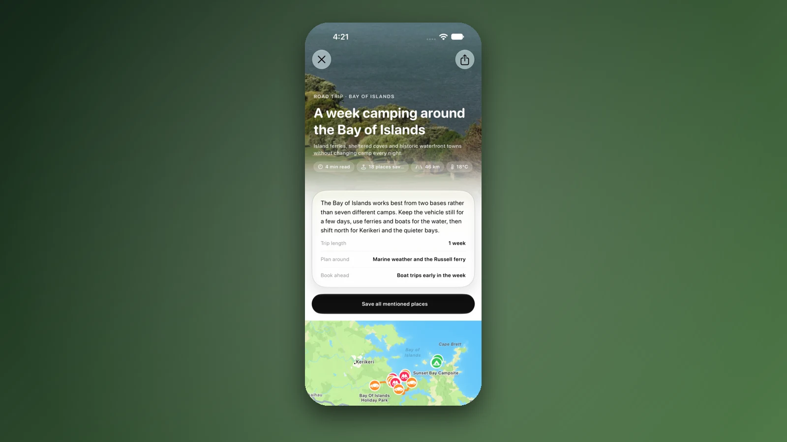
- Order the stops as you will drive them
- Forecast at each place
- Reserve DOC nights on DOC's site
Places along the way
Check before you go
Rules and conditions change. Recheck the official source and the page for your exact park or campground before departure.
- Waitangi Treaty Grounds: how to get here (directions from Auckland)
- Visit Bay of Islands: getting there and around
- WhangareiNZ: getting to Whangārei
- WhangareiNZ: electric vehicles in Whangārei
- WhangareiNZ: camping
- Russell Info: transport and getting to Russell
- Northland Ferries: Bay of Islands vehicle ferry (timetable and fares)
- Northland NZ: Bay of Islands
- Northland NZ: Whangārei and the Tūtūkākā Coast
- Northland NZ: the Welcoming Coast journey
- Northland NZ: Twin Coast Discovery Highway
- DOC: Uretiti Beach Campsite
- DOC: Puriri Bay (Whangaruru North Head) Campsite
- DOC: Puketī Recreation Area Campsite
- NZTA Journey Planner (conditions, holiday traffic and EV chargers)
Common questions
How many hours is Auckland to the Bay of Islands by road?+
Plan on 3 to 3.5 hours at the wheel, plus stops. The Waitangi Treaty Grounds and Visit Bay of Islands both say about three hours, but WhangareiNZ's two and a half hours to Whangārei and Russell Info's 45 minutes on to Kawakawa suggest the upper end. Fuel, meals and holiday traffic come on top.
How far is Auckland to Paihia by road?+
About 240 km. The Treaty Grounds' directions give 165 km to Whangārei, 60 km to Kawakawa and 15 km to Paihia, and those figures are summed here because no official page states a single total.
How much is the Opua car ferry to Russell for a campervan?+
Northland Ferries lists a one-way fare of $19.80 for a 2-berth campervan under 6 m, $33.80 for one of 6 to 8 m and $41.10 or more for larger motorhomes, with passengers included. The operator calls the fares estimates and confirms the price at boarding, and it advises campervans to cross within two hours either side of high tide.
Where can I camp on the way from Auckland to Paihia?+
DOC's Uretiti Beach Campsite, off State Highway 1 between Waipū and Whangārei, has 300 sites and needs a booking. Puriri Bay at Whangaruru North Head has 90 sites and is reached from Russell Road. Freedom camping rules differ by council, and the Whangārei district's are in the Whangārei freedom camping guide.

Plan the drive
Save the stops. Plan the whole trip.
Free to download. BookIt holiday parks and tours are free to browse and book; DOC campsites, huts, dump stations, the in-app guides and trip planning need the Premium pass.
KiwiCamping is an iPhone app. There is no Android version.